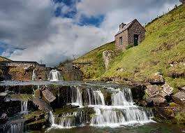
Walk: Mynydd Carn y Cefn from Pen y Fan Pond Country Park. 24km/15miles, 825m/2700ft ascent (Hard)
Mynydd Carn y Cefn from Pen y Fan Pond Country Park. We will start at 9am. OS Explorer Map 166, grid reference SO198007. Head torches essential.
Walk, scramble and climb with us
Our programme of mountain hiking, climbing and other events
Find your adventure with us – try for free for two or three events without commitment to joining. Please register and our membership secretary will contact you.
Tap or click on an event title to obtain full details of the event.
You can filter upcoming events by category, tags or day of the week. How you see the filters depends on your device and its screensize. Some users will see the filter controls appearing on the left side of their screen. For other users, the filter controls can be revealed by tapping on the filter icon ![]() .
.
Read about how we grade our hill and mountain walks and how we categorise our climbing activities.

Mynydd Carn y Cefn from Pen y Fan Pond Country Park. We will start at 9am. OS Explorer Map 166, grid reference SO198007. Head torches essential.

A moderate walk of 19km/12miles with 450m/1476ft of ascent. The Cwmyoy Roundabout will ascend Gaer, Bal Bach (and the option of Bal Mawr - an additional 1.5km and 90m ascent)Continue reading "Walk: Cwmyoy Roundabout. 19km/12miles, 450m/1476ft ascent (Moderate)"

A convivial weekend of walking and pre-Christmas cheer including Christmas Dinner with all the trimmings on Saturday evening, based in Chapel-le-Dale, near Ingleton, North Yorkshire. Handy for the limestone sceneryContinue reading "Christmas meet-up, Yorkshire Dales"

A moderate walk with Rob Kemp. We'll start at 9.30am from the car park. OS Explorer Maps 151 & 166, grid reference SS 968859. Walkers are asked to bring bothContinue reading "Walk: Gilfach Goch Where are we? Where are we going? 18km/11.5 miles, 345m/1150ft ascent (Moderate)"

It's time for the infamous Christmas Pudding Walk which will begin at 10.00am! We'll walk to Mynydd Llangorse and back along the Beacons Way to the Village Hall at aroundContinue reading "Walk: Christmas Pudding Walk Mynydd Llangorse. 8km/5 miles (Short)"

The first Sunday walk of the New Year. This walk will also be a training and practice session for 'finding your way' map-reading skills. It will be especially useful forContinue reading "Walk/Training: Bryn and Waun Rydd. 19km/12 miles, 950m/3100ft ascent (Moderate)"

A circular walk of 6.5km/4miles, 220m/670ft ascent over and around Gray Hill with beautiful views across the River Severn, on a clear night! We'll start at 7pm from the ForesterContinue reading "Walk: Gray Hill. 6.5km/4miles, 212m/700ft ascent (Easy)"

Setting the map, staying engaged with the map whilst walking to maintain awareness of current position, and anticipating what lies ahead are fundamental to being able to find your wayContinue reading "Training (half-day): Finding your way with a map"

Join Dave Bingham for a hard walk to Cribyn via Bryn Teg and Fan Y Big starting at at 9.00am. OS Explorer Map OL12, grid reference SO 074258 at Llanfrynach.Continue reading "Walk: Cribyn via Bryn Teg and Fan Y Big. 24km/15miles, 1000m/3330ft ascent (Hard)"

Join Sara on this moderate walk of 19km/12miles with 700m/2300ft ascent. The walk will take us on an old drovers road from Talywain, skirting around Coety Mountain to Cwmtillery LakesContinue reading "Walk: Talywain to Cwmtillery Lakes. 19km/12miles, 700m/2300ft ascent (Moderate)"

Join Ralph on this 26km/16.5miles hard walk taking in the hills of Mynydd Fforest, Cefn Llwydiart, Cefn Clawdd, Twyn Y Post, Fforest Brycheiniog and Llandyfalle Hill. Total ascent 700m/2300ft followingContinue reading "Walk: Mynydd Fforest and surrounding hills. 26km/16.5miles, 700m/2300ft ascent (Hard)"

Join Nia for a hard walk starting at Pengenffordd heading onto Y Grib and moving North East 713m to the Grwyne Fawr Bothy. Nia has recommended that walkers aim toContinue reading "Walk: Pengenffordd to Grwyne Fawr Bothy. 21km/13miles, 840m/2770m ascent (Hard)"